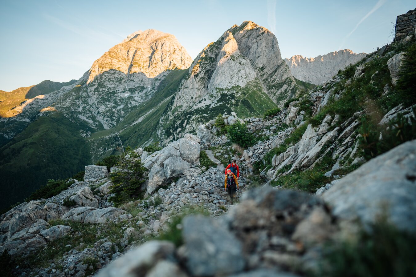
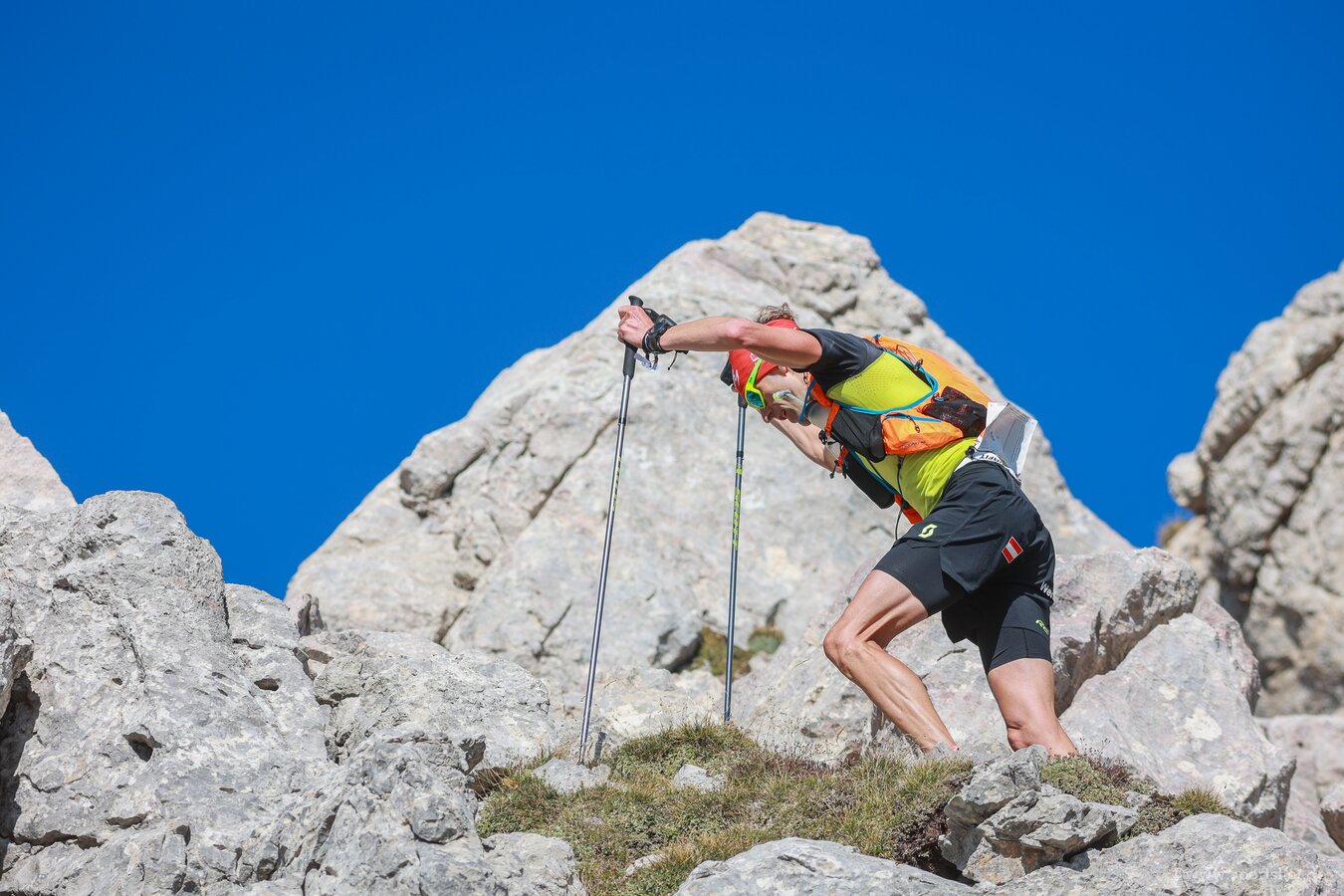
Trailrunning
Trail running is more than just running on surfaced roads - it's a way to experience nature in its purest form. Our region offers a wide range of spectacular trail running routes that take you through majestic forests, along picturesque rivers and across stunning mountain peaks. Feel the thrill as you move over hill and dale and scale new heights. Whether you are an experienced trail runner or just diving into trail running - the trails in the Nassfeld-Pressegger See region offer the right challenge for every runner. From gentle beginner's trails to routes that require technique, there is a trail for every running style and fitness level. Trail running is not only a physical adventure, but also a way to free your mind and leave the stress of everyday life behind.
Nassfeld Easytrail
- Starting point Sonnenalpe Nassfeld
- Running route approx. 2 km slightly uphill in north-westerly direction
- Arrival at Tressdorfer Alm
- After Tressdorfer Alm: another 200 m along the trail in north-westerly direction
- Turn off in a bend towards the south
- The terrain becomes steadily steeper here
- Follow the route in several serpentines along the Millenium Express gondola lift
- Approaching the summit of Madritschen
- Arrival at the Madritschen summit
- At this point you have reached the positive altitude metres
- Return in a few easy bends downhill along the piste
- You will cross the Madritschen chairlift again and again
- Return to the starting point
Nassfeld Speedtrail
- Starting point Sonnenalpe Nassfeld
- Running distance approx. 1.7 km along the piste in westerly direction
- Finish at the upper terminus of the Madritschen cable car
- On this section approx. 400 positive altitude metres reached
- Continue along the piste, running between the upper termini of the Madritschen and Millenium Express cable cars
- Approx. 1.5 km steeply downhill
- Shortly before the reservoir, turn off onto the gravel path towards Rudnig Alm (approx. 2 km)
- Slight ascent on the gravel path to Rudnig Alm
- Approx. 2.5 km downhill towards Tröpolacher Alm
- Pass Tröpolacher Alm and follow the trail into the forest (approx. 3.5 km) to Rattendorfer Alm
- After Rattendorfer Alm, turn off to the south
- Steep ascent follows, circumnavigating the Zottachkopf on the western flank
- The trail turns from south to east and circles the Trogkofel (approx. 1.3 km), which is circumnavigated in southerly direction.
- The highlight here is the scenic view to the south on the traverse below the Trogkofel.
- Passing the Rudnigsattel
- Continue eastwards on a single trail to the reservoir below the Madritschen (approx. 2.5 km).
- Terrain requiring more technique before the reservoir.
- Return to the upper termini of the Madritschen and Millenium Express cable cars.
- Descent along the piste back to the starting point (approx. 1.7 km)
Rauchkofel Trail
- Starting point at the Untere Valentinalm
- Running route approx. 2.5 km in westerly direction to the Obere Valentinalm
- Continue to the "Heiderstein" (large rock with memorial plaque)
- Then left into the high valley below the rock faces of the Kellerwand to Valentintörl
- Follow the Carnic High Route KHW 403 to the left and through the gully
- Short, steep ascent (approx. 720 m) to the peak of the Rauchkofel
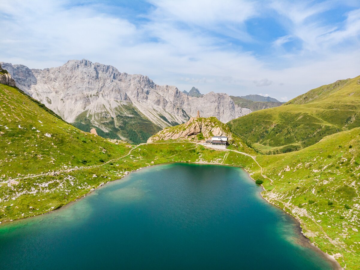
- Return via junction - halfway - to the Wolayersee Hut
- Running route of approx. 1.3 km along the lake to the hut
- Return to the Valentintörl (approx. 1.25 km)
- Same way back to the Untere Valentinalm (approx. 5 km)
Two-Country Trail
- Starting point at the Plöckenhaus
- Run south-east in direction of Angerbachtal valley along the signposts to Freikofel/Cuelat
- Arrival at Freikofel/Cuelat after approx. 3.5 km
- Tip: A visit to the World War I Open-Air Museum at Freikofel/Cuelat is recommended!
- Descent in direction of Großer Pal/Pal Grande
- Running route to the Rossbodentörl/Passo Cavallo (approx. 500 m)
- Then turn right in southerly direction (Italy)
- Follow trail no. 401 in easterly direction
- Pass the Casera Palgrande di Sotto and to the Casera Palgrande di Sopra (approx. 1.8 km)
- Running route in easterly direction to the large basin
- Ascent to the Promos Saddle (approx. 1.5 km, approx. 330 positive altitude metres)
- Further ascent (approx. 1.5 km, approx. 330 positive altitude metres)
- Descent to Lago Avostanis/Lake Avostanis
- Run along the sloping, concrete road to Kronhoftörl/Passo Pramosio (approx. 2.5 km)
- Cross the border back into Austria
- Follow the trail to the fork (approx. 450 m)
- Take the left trail in direction Obere Spielbodenalm
- Arrival at the highest point of the route, Köderkopf
- Descend via approx. 150 hairpin bends to the Frondell Alm (approx. 3 km to the Obere Frondell Alm, approx. 3.5 km to the Untere Frondell Alm)
- Run along the forest trail into the Krohnhofgraben
- Follow the stream north towards Kronhof
- Running route to Weidenburg to the finishing point (approx. 3.5 km)
Nassfeld Sky Ultra
- Starting point Sonnenalpe Nassfeld
- Run approx. 1.7 km along the piste towards the west
- Upper terminus of the Madritschen cable car
- Approx. 400 positive altitude metres on this section
- Continue along the Austrian-Italian border for approx. 700 m
- Turn south and enter Italy
- Approx. 500 m slightly downhill to the south
- Turn left and run in easterly direction for approx. 1.7 km
- Turn right and run in south-easterly direction along serpentines
- Pass Sella della Pridola, south of Monte Malvuerich Alto and west of Monte Malvuerich Basso (approx. 2.8 km)
- Steep descent to the south and then to the west (approx. 2 km, approx. 500 negative altitude metres)
- Reaching the Conca di Pricot alpine pasture
- Long ascent back to the Austrian-Italian border (approx. 4.8 km, approx. 850 positive altitude metres)
- Circumnavigate the Hinterrosskofel/Creta di Pricotic on the western flank
- Cross the border and continue in north-westerly direction across the Rudnigsattel/Sella di Aip (approx. 2.2 km)
- Turn right and steep descent before Trogkofel/Creta di Aip
- Through scree field and overgrown area, return to the path after approx. 1.8 km
- Follow the path with a detour via the piste towards Tröpolacher Alm (approx. 2.7 km)
- Continue towards Rattendorfer Alm (approx. 3 km)
- Turn right and follow flat Rattendorfer Alm trail (approx. 6.5 km)
- Longest ascent of the route (approx. 9.4 km, approx. 1,150 positive altitude metres)
- Pass the Windschaufel and reach the summit of Hochwipfel
- Descent (approx. 4.8 km, approx. 620 negative altitude metres) past the Schulter/Creta di Lanza to Rattendorfer Alm
- After the Rattendorfer Alm, turn off to the south
- Follow the trail to the Steinerne Meer (approx. 750 m) and then to the Sagmeistersteig trail
- Section requiring technique (approx. 1 km) through the Steinerne Meer to the summit of the Zottachkopf
- Descent between Zottachkopf and Trogkofel/Creta di Aip (approx. 2.9 km)
- Scenic highlight on the traverse below the Trogkofel/Creta di Aip
- Passing the Rudnigsattel/Sella di Aip again
- Descent on a steep single trail to the reservoir below Madritschen/Monte Madrizze (approx. 1.3 km)
- Terrain requiring technique before the reservoir
- Return to the upper termini of the Madritschen and Millennium Express cable cars
- Descent along the piste back to the starting point (approx. 1.7 km)
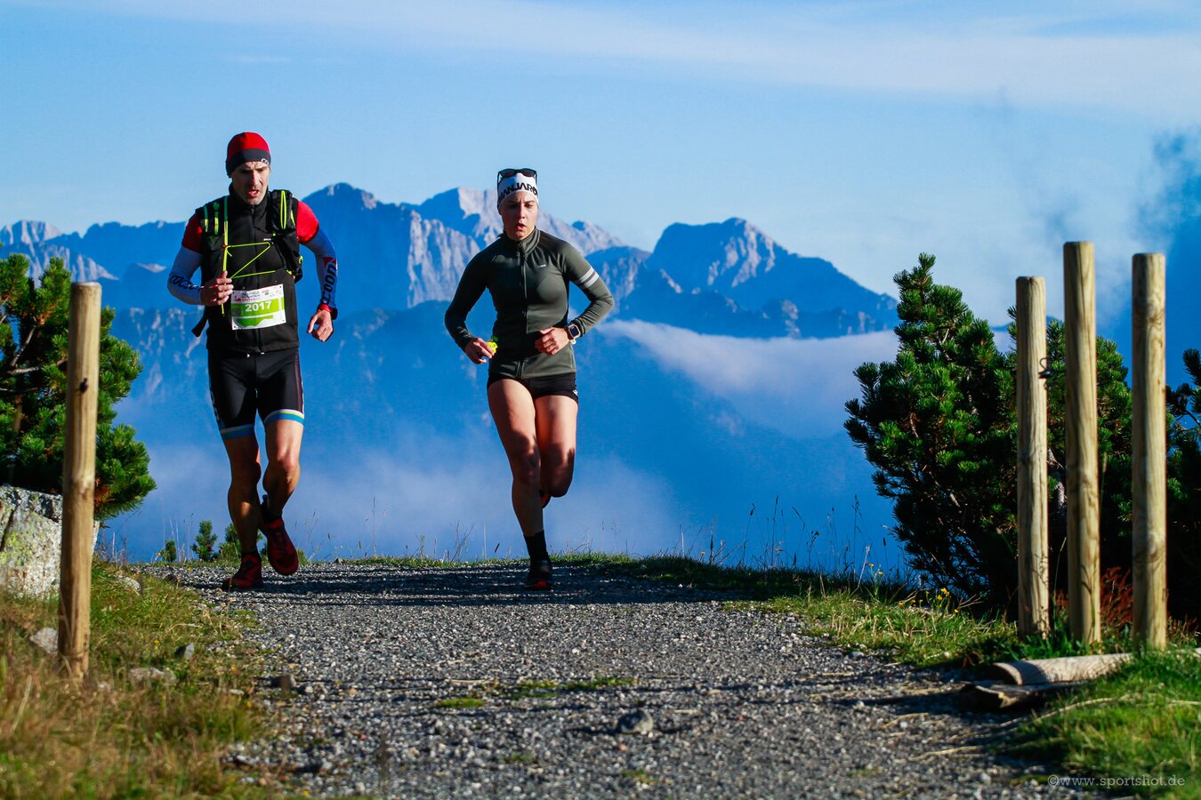
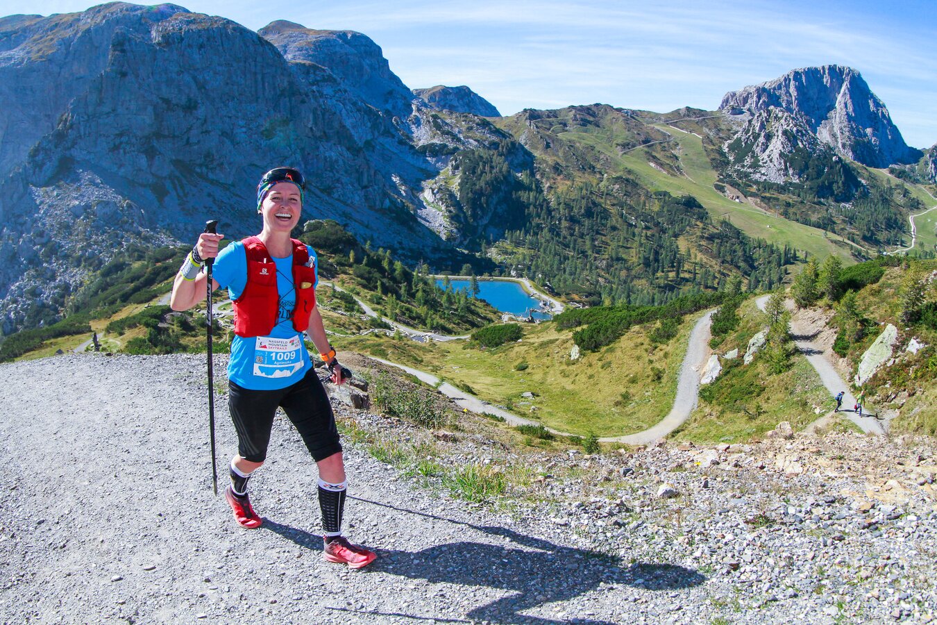
Nassfeld-Mountain-Skytrails
At Nassfeld-Mountain-Skytrails, international skytrail runners compete at Austria's southernmost skyrunning & trail running event. Four trails of varying levels of difficulty around the Nassfeld Pass must be conquered. This year’s event will take place from 15 to 17 September 2023.


